Geo Information
Remote Sensing
Introduction
Centre for the Remote Sensing was established in 1980 with the commencement of the Swiss/Sri Lanka Satellite Remote Sensing Project. Satellite Remote Sensing was introduced to Sri Lanka Survey Department in late 1970’s. The Sri Lanka Centre for Remote Sensing of the Survey Department is the focal point of the Satellite Remote Sensing under the UN-ESCAP since 1996.
Activities of Centre for Remote Sensing
-
Purchasing, Processing and storage of good quality satellite images using local funds. Those data been used for updating topographic databases.
-
Data extraction from high resolution satellites for 1: 50,000 new topographic databases.
-
Interpretation of aerial photographs and satellite images for special purposes other than the 1:50,000 Topographical mapping.
-
Conduct knowledge sharing sessions on remote sensing activities for the users
-
Supporting other organization in their use of remote sensing applications
Main outputs of the Remote Sensing branch since 1980
-
Produced 1:100,000 landuse maps for the entire country using Aerial Photographs.
-
Create GIS for Bulathsinhala and Weeraketiya Divisional Secretariats in 1998 under the Sri Lanka Swiss Planning Support Project.
-
Produced 1:50,000 landuse maps for 37 sheets out of 92 using Aerial Photographs.
-
1:10,000 Topographical maps for the Tsunami effected areas under the Spatial Information Infrastructure for Reconstruction Monitoring Project SIIRM Project (2008-2009) using high resolution satellite images.
-
Prepared new road network of Sri Lanka using high resolution satellite data and graded according to the RDA specifications in 2012.
-
Prepared Land use Data for whole courage of years 2000, 2005, 2010 & 2015 using Landsat images under UNREDD project in the period of 2015-2016.
-
Produced 1:50,000 Topographical database using high resolution satellite images to cover entire country at the end of 2018.
Ongoing activities
Updating 1:10,000 Topographical database using high resolution satellite images started in 2019.
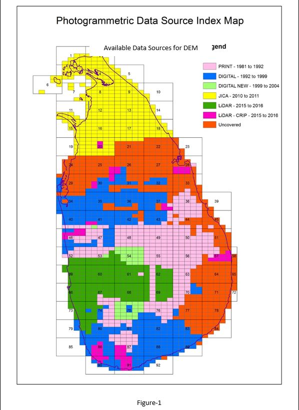
Creation of Digital Elevation Model to cover entire country by combination of all available latest terrain data with the Survey Department. Planned to complete at the end of year 2022. (See Figure-1 for all available data sources for creation of DEM)

Updating of 1:50,000 Topographical databases which was created in 2018, using the latest satellite images, Geo Names database and other databases.
Creation of 1:50,000 Terrain Feature Class using the newly created Digital Elevation Model.
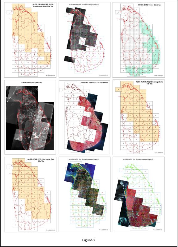
Collect satellite images to have a full coverage of the island wide high resolution images. (See Figure-2 for available satellite image coverage maps).

Updating 1:10,000 and 1:50,000 Topographical databases using high resolution satellite images and other databases.
Built a close relationship with remote sensing users for sharing knowledge & conducting training programme for various remote sensing users.