Geodetic Survey
CORS Network
In 1993 the geodetic control network of Sri Lanka was upgraded by using global positioning system. The transformation parameters were computed from the global datum called WGS84 to local datum called Everest 1830. Hence Global Navigation Satellite System can be used to obtain the national grid system in centimeter level accuracy.
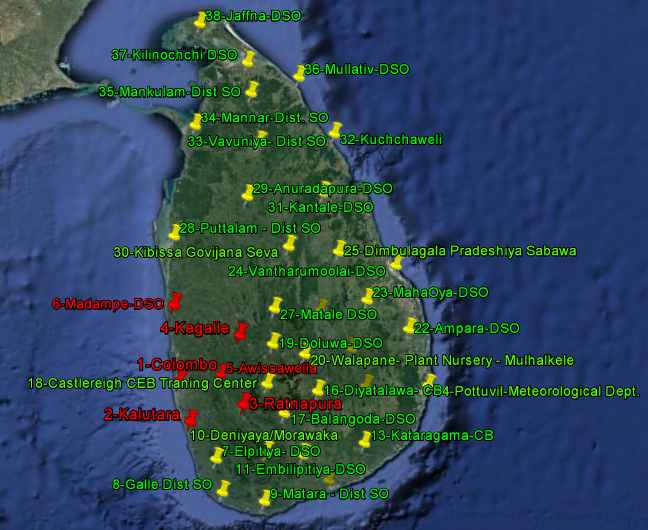
Sri Lanka Continuously Operating Reference Station Network (SLCORSnet),established at the end of 2016, comprises of physical GNSS reference stations at remote designated locations that transmit the collected GNSS raw data live to the Control Centre based in Colombo at the Surveyor General’s Office. This raw data is processed using a GNSS network processing software housed at the Control Centre which then will be transmitted to the users in the field over the internet based on their geographic location in the form of RTCM corrections. Online delivery of RINEX raw data and online post-processing services are provided as real-time web services from the SLCORSnet.